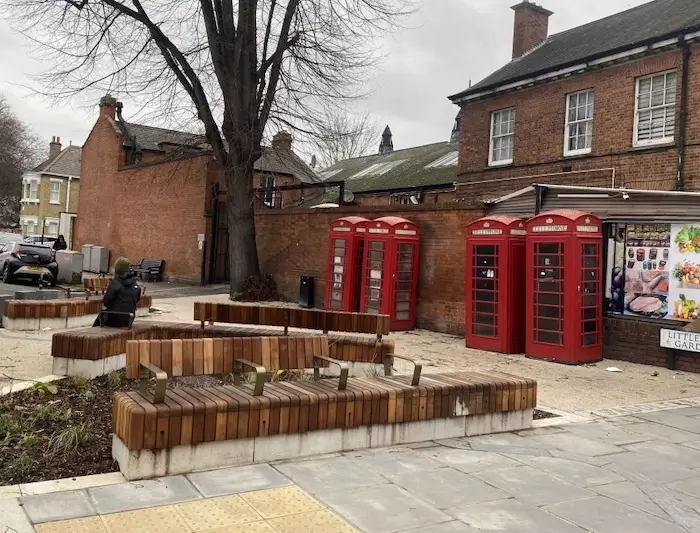
A ribbon-cutting ceremony this Saturday will mark the formal completion of the first phase of the Enfield Town Liveable Neighbourhood project.
 The new Saddlers Square is named after the Saddlers Mill Stream, which flows through Enfield Town but for many years has been buried underground
Enfield Council is inviting residents to a ceremony to officially open a new public square in Enfield Town at 11am on Saturday 25th. "Saddlers Square" has been created by closing off the former junction of Church Street and Little Park Gardens, close to Enfield Town post office. Its features include benches and "rain gardens", designed to provide both greenery and to filter out pollution from rainwater before it enters local streams and rivers.
Saddlers Square is named after the Saddlers Mill Stream, which flows through Enfield and Edmonton. Almost all of the stream was culverted many years ago, but a short section is still visible between Village Road and Wellington Road in Bush Hill Park.
The new square is just one of the changes introduced by phase 1 of the Enfield Town Liveable Neighbourhood project, which has the aim of making the town centre safer and pleasanter for people on foot by making it easier to cross roads.
 Map showing the full extent of the Enfield Town Liveable Neighbourhood project (within the dashed lines). Phase 1 is the area with magenta shading in the north western corner. The rest of the improvements will be delivered in further phases as funding for them becomes available.
Other features of phase 1 include changes which make it easier and safer to walk between the northern side of Church Street and the main entrance to Town Park, via the Library Green.
Main features of Enfield Liveable Neighbourhood phase 1
- Closure of the eastern end of Little Park Gardens at its junction with Church Street to create Saddlers Square
- Changes to how traffic accesses Little Park Gardens
- A mew signalised crossing at the junction of Church Street and Sarnesfield Road
- Replacement of the zebra crossing in Cecil Road by a toucan (pedestrians and cyclists) crossing in a new location
- Creation of a diagonal path across Library Green linking the two new crossing points at the Church Street/Sarnesfield Road junction and in Cecil Road
- Changes to waiting and loading
Sabri Ozaydin, the council’s cabinet member for climate action and placemaking, said: “I am delighted the first phase of the Enfield Town Liveable Neighbourhood project has now been completed.
“The borough’s residents have been integral to the development of the project, as their views and vision to help improve the town centre has helped to shape the design. I would like to invite all residents and their friends and family to join me at the official opening of Saddlers Square, for what will be a fantastic celebration.
“I hope these transformational changes will encourage more people to visit Enfield Town actively and to explore the beautiful decorations that celebrate our heritage and community.”
The Council commissioned artist James Tunnard to create new artworks for Saddlers Square, as part of a wider arts trail that will connect different sites throughout Enfield Town.
James designed ‘Riverpath’ and a series of Stepping Posts, created in stone and inspired by Saddlers Square’s proximity to nature and water, and Enfield Town’s strong literary connections.
James worked closely with Year 3 pupils from George Spicer School in Southbury Road and with the Enfield Poets, who created fish motifs and original poetry, which have been incorporated into the artworks, alongside the poetry of John Keats.
This phase of the project has been paid for by a combination of funding from Transport for London and community infrastructure levy (CIL) money received from developers.
What can we expect in future phases of the scheme?
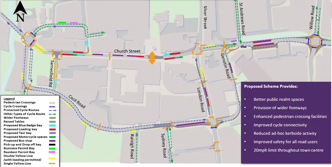
The complete Liveable Neighbourhood scheme, as consulted on and described over the past five years or so, extends from the Little Park Gardens junction with Church Street in the west as far east as the junction of Southbury Road and Willow Road. The shaded section below contains extracts from information that was published by the council in 2022 but is no longer on the council website. The most important features are cycle lanes in both directions along Cecil Road and remodelling of the area in front of Enfield Town station to create a pedestrian-friendly environment. The council is currently seeking funding for phase 2, which will probably be the area around Enfield Town station.
The Enfield Town Liveable Neighbourhood proposals in summer 2022
The main changes proposed in the plan
- Enhancement of the Market Square in collaboration with the Old Enfield Charitable Trust and St Andrew's Church
- A new public square at the junction of Little Park Gardens and Church Street (outside Nationwide Building Society)
- A more vibrant public space on 'Fountain Island'
- A better experience when arriving at Enfield Town Station and entering the town centre
- An improved connection between the Market Square and the shopping centre entrance
- An upgraded link between the Library Green and Enfield Town Park
- Improved greening across the town centre
- Improved and new pedestrian crossings throughout the town centre
- Wider footways in some locations
- Safer cycling options and connecting the town centre with nearby cycle routes
- Improved bus stop accessibility
- Revised parking and loading restrictions
- Dedicated Blue Badge disabled parking bays throughout the town centre
- Improved safety, including improved CCTV and proposed 20 mph speed limit on all roads in the town centre
Links
Enfield Town page on the Let's Talk Enfield website
New public square in Enfield Town to be officially opened (Enfield Dispatch 21 January 2025)
Enfield Town pedestrian improvements work starting this week (Palmers Green Community 3 July 2024)
Enfield Town Liveable Neighbourhood: construction of phase 1 scheduled for this summer (Palmers Green Community 13 February 2024)


