Enfield and Barnet councils have launched a joint project looking at the potential for improving the New Southgate area. The first phase is a public engagement aimed at finding out what the local community like about their area, what they don't like and their ideas for improvements.
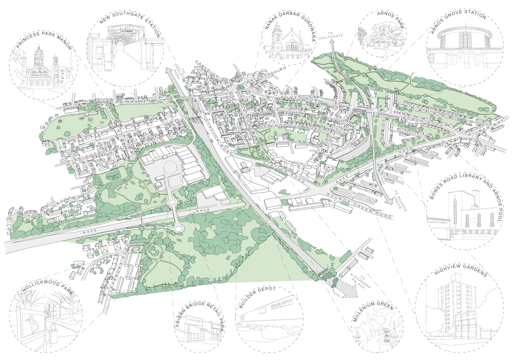
 A map showing important locations in the New Southgate Opportunity Area. The grey strip running from top to bottom is the East Coast Main Line
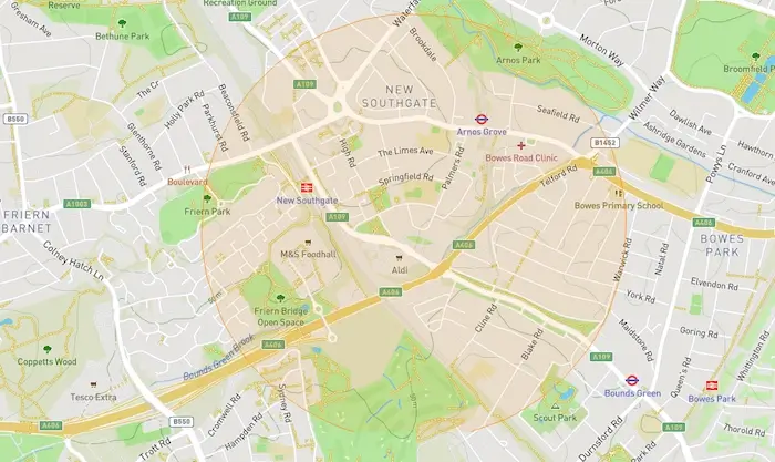
The context in which the two councils are working is the designation in the 2021 London Plan of the New Southgate Opportunity Area (OA), which was identified as having the potential for 2,500 new homes and 3,000 new jobs by 2041. The exact boundaries of the OA have yet to be decided - it's shown on the official maps as a circular blob covering parts of not only Enfield and Barnet, but also part of Haringey.
New Southgate is earmarked as an Opportunity Area in the Mayor’s London Plan 2021. This designation means it has the potential for new homes, jobs, and infrastructure improvements.
To work cohesively, Enfield and Barnet Councils have come together to understand what is good and what needs to change in the area. Our first step is coming to talk to the community to get your perspective on this. We are interested in hearing about it all – parks, community facilities, bus routes or anything else on your mind.
These views will be used as a basis to inform future cross-borough work on improving the area. We will be publishing the results of this engagement online once completed.
 People taking part in the consultation can use coloured pins to indicate problems, good features and ideas for improvements. The circle represents the Opportunity Area.
For the engagement that's now under way on the Let's Talk Enfield website, the council is using an interactive map that people can add coloured pins to - red for "issue", yellow for "idea" and green for "positive" - and add some text. This too includes a highlighted circular area indicating the Opportunity Area, but the council's Journeys & Places team say they "welcome any views on any place you consider to be within New Southgate, both in and outside the circle shown".
Please use this map to place pins in the location of:
- What you like in New Southgate
- What you don't like in New Southgate
- What could be improved in New Southgate
This can be in relation to anything regarding the built environment within the map boundary. Some suggestions could include: existing cycle or pedestrian routes, green spaces, public infrastructure, public transport, shops and community spaces. Additionally any detailed information including commonly used routes, or places you might avoid e.g. routes you might not take at night.
This tool allows you to select a red 'issue' pin, a yellow 'idea' pin, or a green 'positive' pin and place it on the map in the location you are referring to.
Source: letstalk.enfield.gov.uk/newsouthgate/maps/new-southgate
As well as using the interactive map, people can give their views using an online survey. The survey and interactive map will be available until 2nd November.
Additionally, there will be two face-to-face engagement events: a Community Drop-in on 23rd October (3pm to 8pm at the Ladderswood Community Centre) and an After Dark Walkabout on 26th October, starting at New Southgate Station and ending at Arnos Grove Station (this will only happen if enough people register to participate). To find out what young people think about their area, Journeys & Places will also be visiting a local school.


